Ouachita Mountains (Mount Ida, Jessieville, Hot Springs)
Hundreds of quartz pockets along the Crystal Belt. Pay-to-dig mines (Ron Coleman, Wegner, Sweet Surrender) plus public collecting on Ouachita National Forest land.
32 mapped spots across 7 counties. Arkansas is known to rockhounds for quartz crystals in the Ouachita Mountains and public diamond digging at Crater of Diamonds State Park. Mount Ida, Jessieville, and Hot Springs are the main quartz areas.
Representative spot and material photos from locations in this state, shown where verified public image records are available.
Map showing 32 rockhounding spots in Arkansas
Counts reflect how many spots in this list mention each mineral.
Notable areas: Mount Ida quartz, Jessieville quartz, and Crater of Diamonds finds are the main Arkansas targets.
The Ouachita Mountains are a Paleozoic fold-and-thrust belt where quartz veins formed as silica-rich fluids moved through the Crystal Mountain sandstone. The main quartz belt runs roughly 30 miles around Mount Ida. Southwest Arkansas has a separate diamond source, the Prairie Creek lamproite, now exposed at Crater of Diamonds State Park.
Hundreds of quartz pockets along the Crystal Belt. Pay-to-dig mines (Ron Coleman, Wegner, Sweet Surrender) plus public collecting on Ouachita National Forest land.
The only diamond-producing site in the world open to public digging. Pay an entry fee, dig the plow zone, and you keep what you find — including diamonds.
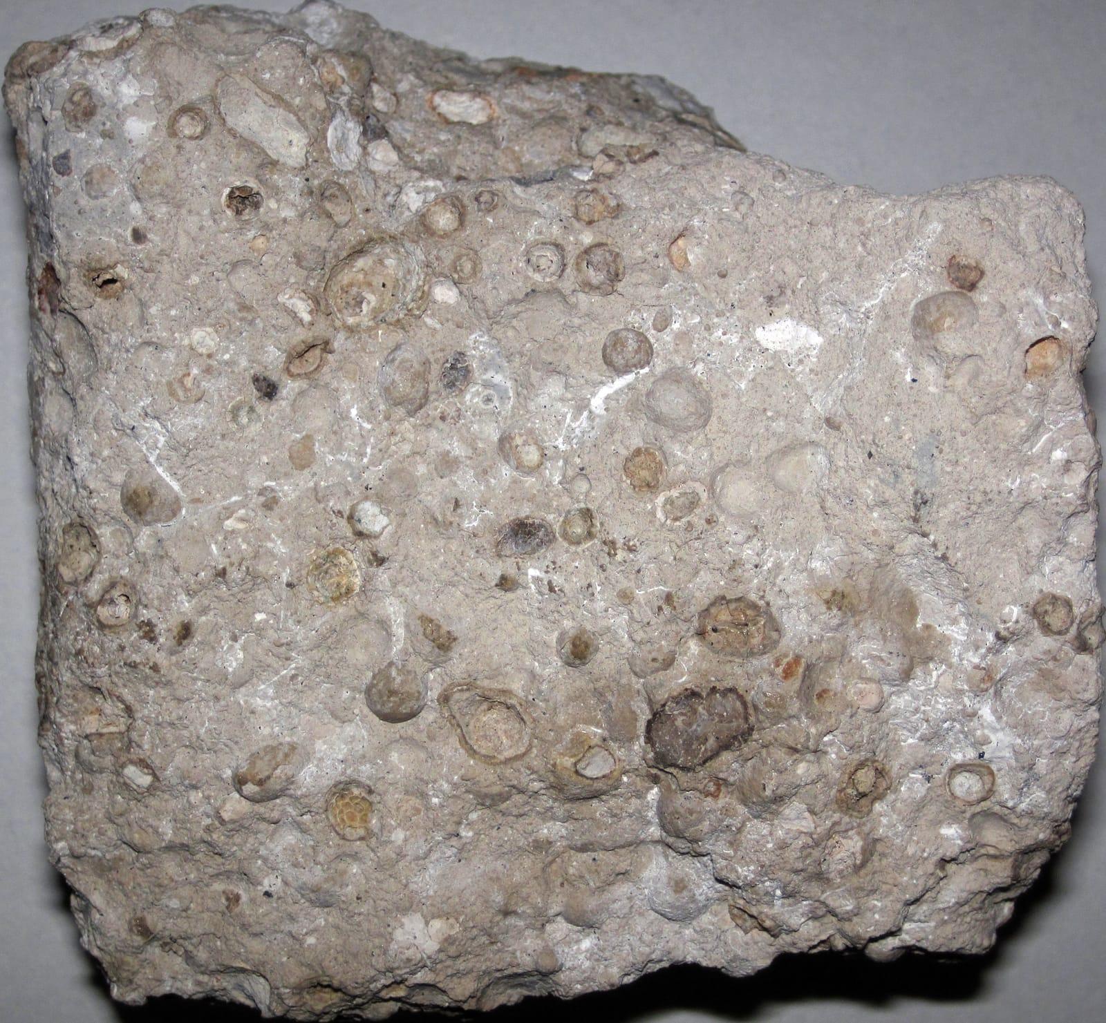
Bauxite, Mississippian fossils such as crinoids and brachiopods, and minor barite. The Ouachitas get more attention, but the Ozarks are useful for fossil trips.
March through May and September through November. Summers are hot and humid; winters are workable. At Crater of Diamonds, heavy rain can expose fresh material in the plowed field.
Ouachita digs: a sturdy mattock, gads, gloves, and a sprayer to clean crystals on site. Crater of Diamonds: a shovel, bucket, two screen boxes (1/4-inch and window-screen), and patience — there's a rhythm to wet-sieving the lamproite gravels.
The Mount Ida area has been mined commercially for quartz since the early 1900s; many of today's pay-to-dig sites are former optical-grade mines from the World War II era. Crater of Diamonds was opened to public digging in 1972 and has produced more than 35,000 diamonds in that time.
Day-trip range. Each section lists the closest mapped rockhounding spots within about 150 miles of the city — most are inside a 2 to 3 hour drive.
6 closest spots to Little Rock, AR.
6 closest spots to Hot Springs, AR.
Geology rarely respects state borders. These states share mapped rockhounding country with Arkansas — useful when Arkansas is the start, not the whole trip. Each card links to the closest county across the line.
County pages are linked once we have at least 3 mapped spots for a focused guide with coordinates, mineral notes, and nearby spots.
Hand-picked standouts from the Arkansas list, chosen for unusual mineralogy, documented public access, or both. Each card links to coordinates, access notes, and what to look for.
 Top pick
Hot Spring County
Magnet Cove is a classic alkaline igneous complex, noted in USGS work for nepheline syenite, carbonatite, and titanium-bearing minerals such as perovskite and titanite. Its unusual Cretaceous intrusive rocks make this small Hot Spring County area one of Arkansas's most mineralogically distinctive collecting districts.
Sphene, Nepheline Syenite
 Top pick
Hot Spring County
Kimzeyite and perovskite give the Cove Creek Bridge area its weight: Perovskite Hill and the nearby Kimzey carbonatite localities are documented Magnet Cove occurrences rather than generic creek gravel. The appeal is the chance to study loose material tied to Arkansas's alkaline-carbonatite complex, where apatite, magnetite, monticellite, and zirconium-bearing garnet occur in a tight geologic setting.
Apatite, Monticellite, Magnetite, Perovskite
 Top pick
Montgomery County
Clear hydrothermal quartz is the draw here, part of the Ouachita Mountain quartz belt that USGS and the Arkansas Geological Survey describe as one of western Arkansas's signature mineral resources. The Mount Ida area is especially useful because quartz-bearing veins and crystal pockets occur close to established digging operations.
Quartz
 Top pick
Montgomery County
Mount Ida sits in the heart of Arkansas's Ouachita quartz province, where hot fluids moved through fractured Paleozoic sandstone, shale, and chert to form crystal-bearing veins. That regional geology, documented by USGS and the Arkansas Geological Survey, is why the area remains the state's clearest benchmark locality for rock crystal collecting.
Quartz
 Top pick
Montgomery County
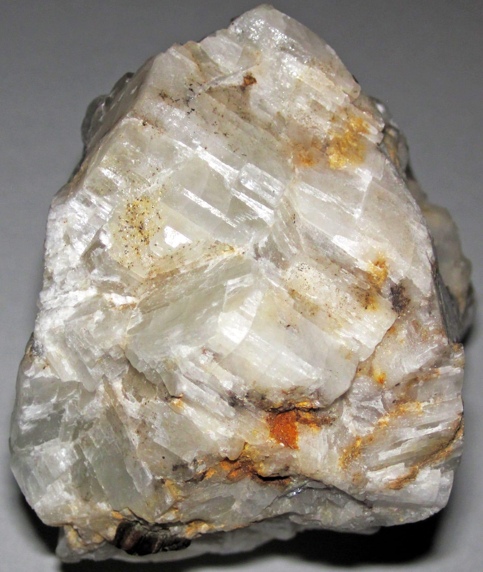
Mauldin Mountain wavellite is not an interchangeable green phosphate, Mindat and Arkansas Geological Survey references tie the quarries to botryoidal wavellite, variscite, planerite, and related phosphate minerals. The locality stands out because the best material shows radial, spherical aggregates that make the Montgomery County occurrence recognizable in collections.
Wavellite
 Top pick
Pike County
Crater of Diamonds is exceptional because visitors search the eroded surface of a diamond-bearing Prairie Creek lamproite and may keep diamonds and other minerals they find. Arkansas State Parks and the Arkansas Geological Survey both document the park's volcanic pipe, its 37-acre search field, and its companion minerals, including amethyst, garnet, jasper, and agate.
Diamond, Amethyst, Garnet, Jasper
 Top pick
Pike County
Prairie Creek is the geologic source behind the Crater of Diamonds field, a lamproite diatreme with diamonds plus mantle and alteration minerals such as chrome diopside, epidote, garnet, hematite, and amethyst. Its value as a rockhounding landmark comes from that rare volcanic pipe, not from ordinary stream gravel.
Amethyst, Diopside, Epidote, Garnet
 Top pick
Marion County
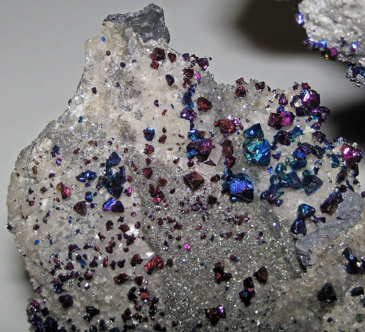
Yellville belongs to north Arkansas's historic lead-zinc belt, where Arkansas Geological Survey summaries record galena, sphalerite, and smithsonite production from Marion County and nearby Ozark districts. The mine-dump setting is notable because it exposes a compact suite of sulfide and carbonate zinc minerals in a state better known to many collectors for quartz and diamonds.
Galena, Pyrite, Smithsonite, Sphalerite
 Top pick
Garland County
The south side of Lake Catherine is tied to Garland County fluorite occurrences noted in Arkansas Geological Survey mineral-deposit reports and Mindat locality records. That makes the site a focused stop for a single, recognizable mineral rather than a broad mixed-gravel locality.
Fluorite
 Top pick
Saline County
Saline County is one of the two districts in the Arkansas bauxite region, a roughly 275-square-mile belt described by the Arkansas Geological Survey and USGS as the state's historic aluminum-ore province. The quarries stand out because the material is tied to weathered syenite and related intrusive rocks rather than ordinary clay or ironstone.
Bauxite, Heliotrope Bauxite
Sorted by county. Tap coordinates to open in Google Maps, or open RockHoundR for the full map view with land overlays and weather.
Open the RockHoundR app to see Arkansas on a real map with public land overlays, weather, geology, and your saved finds.
