Spruce Pine pegmatite district (Mitchell County)
Aquamarine, beryl, garnet, smoky quartz, feldspar, and mica on private mines and dumps (Crabtree Emerald Mine, Emerald Hollow Mine, Rio Doce, and others). Mostly fee-dig.
198 mapped spots across 56 counties. North Carolina has a long gem-mining record, especially in the western mountains. Hiddenite emeralds, Cowee Valley rubies and sapphires, Spruce Pine pegmatites, and fee-dig mines are the main draw.
Representative spot and material photos from locations in this state, shown where verified public image records are available.
Map showing 198 rockhounding spots in North Carolina
Counts reflect how many spots in this list mention each mineral.
Notable areas: Hiddenite emeralds, Cowee Valley corundum, Spruce Pine quartz and aquamarine, and emerald, garnet, and beryl pegmatites are highlights.
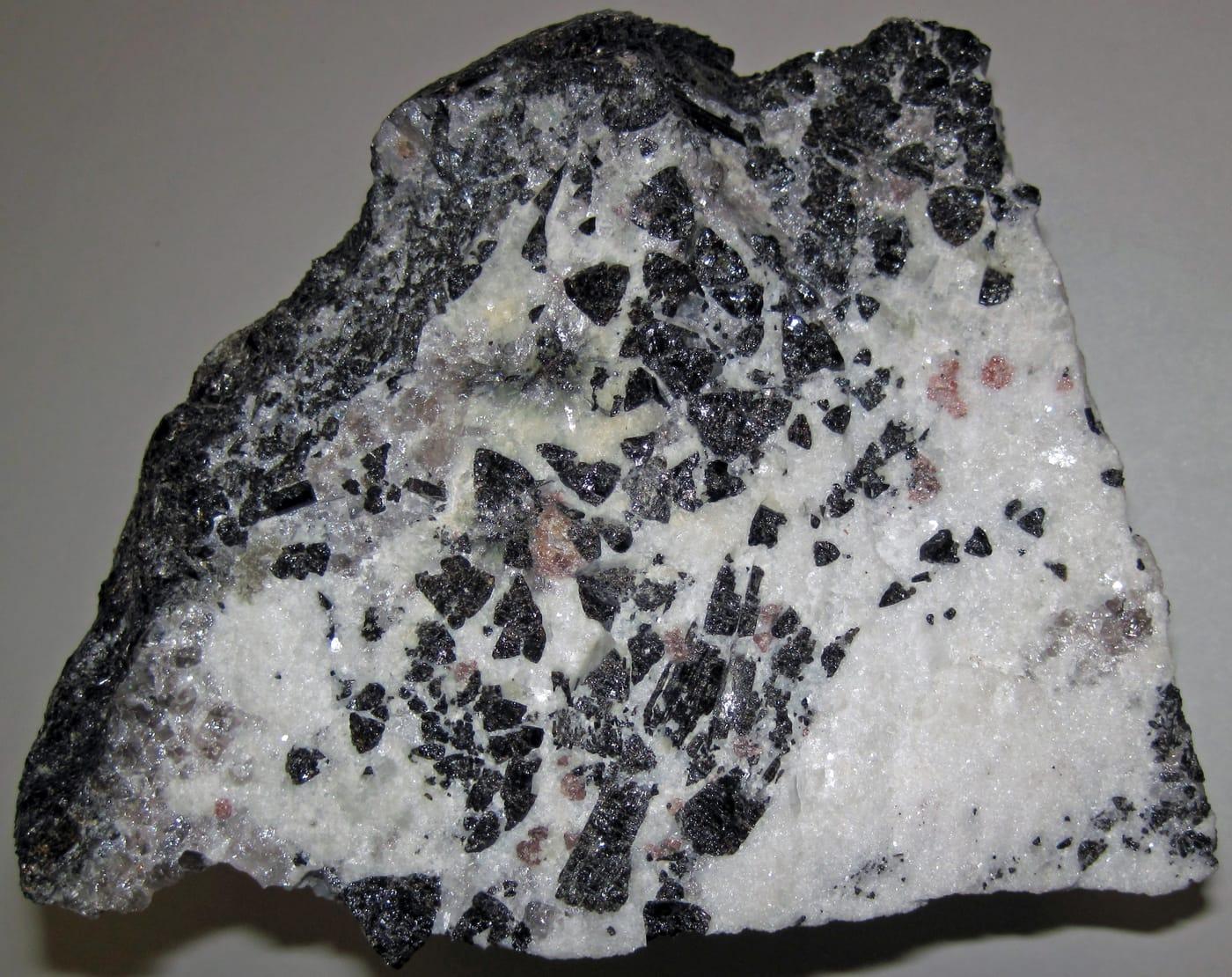
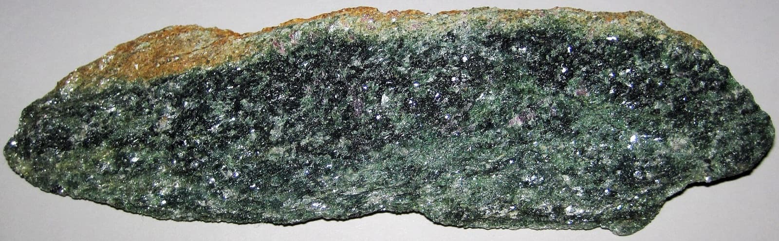
Western North Carolina sits on the Blue Ridge, where high-grade metamorphic rocks are cut by pegmatites. The Spruce Pine pegmatite district produces emerald, aquamarine, beryl, mica, feldspar, and high-purity quartz. Cowee Valley near Franklin sits over corundum-bearing schists. Hiddenite, in Alexander County, is the type locality for the green spodumene mineral hiddenite.
Aquamarine, beryl, garnet, smoky quartz, feldspar, and mica on private mines and dumps (Crabtree Emerald Mine, Emerald Hollow Mine, Rio Doce, and others). Mostly fee-dig.
Ruby and sapphire fee-dig flumes — Mason's Ruby and Sapphire Mine, Mason Mountain, Sheffield Mine. Many salt the buckets with imported gems for value; native finds still happen, particularly at Mason's.
Emerald Hollow Mine in Hiddenite is the only emerald mine in the U.S. open to the public for digging. Also produces hiddenite (green spodumene), garnet, quartz crystals.
Gold panning in Reed Gold Mine country and Uwharrie creeks; offshore megalodon teeth scuba dives off Wilmington and along North Topsail.
April through October. Most mountain fee-dig mines close for winter (typically November–March). Coastal megalodon dives run year-round, weather permitting.
Fee-dig mines supply most tools (screens, shovels, picks). Bring sturdy shoes, a hand lens, a sun hat, and patience. For native digs (Crabtree, Emerald Hollow's creek), bring your own hammer and chisels.
North Carolina's gem mining tradition started in 1799 with the first authenticated U.S. gold find at Reed Gold Mine. Hiddenite was first described in 1879 by a mineralogist from Asheville. Cowee Valley ruby mines have operated continuously since the 1870s.
Day-trip range. Each section lists the closest mapped rockhounding spots within about 150 miles of the city — most are inside a 2 to 3 hour drive.
6 closest spots to Charlotte, NC.
6 closest spots to Raleigh, NC.
6 closest spots to Greensboro, NC.
Geology rarely respects state borders. These states share mapped rockhounding country with North Carolina — useful when North Carolina is the start, not the whole trip. Each card links to the closest county across the line.
County pages are linked once we have at least 3 mapped spots for a focused guide with coordinates, mineral notes, and nearby spots.
Hand-picked standouts from the North Carolina list, chosen for unusual mineralogy, documented public access, or both. Each card links to coordinates, access notes, and what to look for.
 Top pick
Madison County
Little Pine is a focused almandine locality where Mindat records red garnets up to 6 inches in green chlorite schist, a scale that separates it from ordinary garnet-bearing roadcuts. NCGS collecting-site references and later geologic work tie the mine to unusual Mg- and Al-rich schists in the western Blue Ridge.
Garnet, Quartz, Chlorite
 Top pick
Burke County
Linville Mountain is a useful Burke County contrast because NCGS collecting-site maps call out itacolumite, a flexible quartzite, along with pyrophyllite and related metamorphic minerals. The site is less about gemstones and more about unusual Blue Ridge rock types exposed near public mountain roads.
Actinolite, Graphite, Manaccanite, Pyrophyllite
 Top pick
Cherokee County
Vengeance Creek is one of the better free Cherokee County entries for staurolite, with garnet, quartz, and calcite adding a compact metamorphic suite. It earns a place because the locality sits in the Nantahala National Forest collecting framework, where limited surface collecting is possible outside closed or sensitive areas.
Calcite, Garnet, Quartz, Staurolite
 Top pick
Cherokee County
The Little Snowbird Mountains add chloritoid, ottrelite, staurolite, garnet, and gold to the western North Carolina set, a distinctly metamorphic association rather than another pegmatite stop. NCGS gold and collecting-site references place Cherokee County in the state's historic western gold and staurolite country, while National Forest rules provide the public-access framework.
Chloritoid, Ottrelite, Garnet, Gold
 Top pick
Clay County
Chunky Gal Mountain stands out because the Buck Creek dunite body is a named mafic-ultramafic complex, not just a generic mountain roadcut. Historic Bureau of Mines work describes the Buck Creek corundum area as one of North Carolina's important corundum settings, and the public National Forest approach keeps it relevant for careful surface collecting.
Garnet, Staurolite
 Top pick
Macon County
Corundum Hill belongs to the Cowee Valley ruby and sapphire belt, one of the classic eastern U.S. corundum districts described in early USGS work. The appeal is specific rather than general: pink, blue, and green corundum occurs with chromite and olivine in a named Macon County ultramafic setting.
Corundum, Ruby, Blue Sapphire, Green Sapphire
 Top pick
Yancey County
Ray Mine gives North Carolina a rare free public pegmatite locality, with Mindat documenting aquamarine, beryl, amazonite, muscovite, rutile, tourmaline, and other Spruce Pine district minerals. Its strength is the combination of a historically worked mica mine and Forest Service surface-collecting access, provided current closures and mine hazards are respected.
Albite, Amazonite, Apatite, Aquamarine
 Top pick
Montgomery County
Eldorado is the Uwharrie-region gold and base-metal pick, tied to the Carolina Slate Belt rather than the Blue Ridge gem belts. Gold, pyrite, sphalerite, smithsonite, malachite, and azurite give the area a compact mining-district mineral suite, with public-land collecting rules requiring close attention to old workings and ownership.
Azurite, Calcite, Gold, Malachite
 Top pick
Stokes County
Danbury is the best northern Piedmont silica stop in this set, with agate, carnelian, chalcedony, jasper, hyalite opal, hematite, and amethyst listed from the Stokes County area. It broadens the North Carolina top 10 beyond mines and pegmatites by representing the Sauratown Mountains' smaller but distinctive lapidary material.
Agate, Carnelian, Chalcedony, Jasper
 Top pick
Vance County
Island Creek represents the Hamme tungsten district, where NCGS work identifies hubnerite-bearing veins with quartz, sericite, fluorite, and scheelite at the Tungsten Queen mine. That tungsten-fluorite-sulfide suite gives Vance County a very different collecting story from the Blue Ridge pegmatites and Macon County corundum fields.
Apatite, Chalcopyrite, Fluorite, Galena
Sorted by county. Tap coordinates to open in Google Maps, or open RockHoundR for the full map view with land overlays and weather.
Open the RockHoundR app to see North Carolina on a real map with public land overlays, weather, geology, and your saved finds.
