Drummond Island (Pudding Stone): Pudding Stone & Jasper Conglomerate Rockhounding in Chippewa County, Michigan
- Minerals reported
- 3
- Best months
- April to October
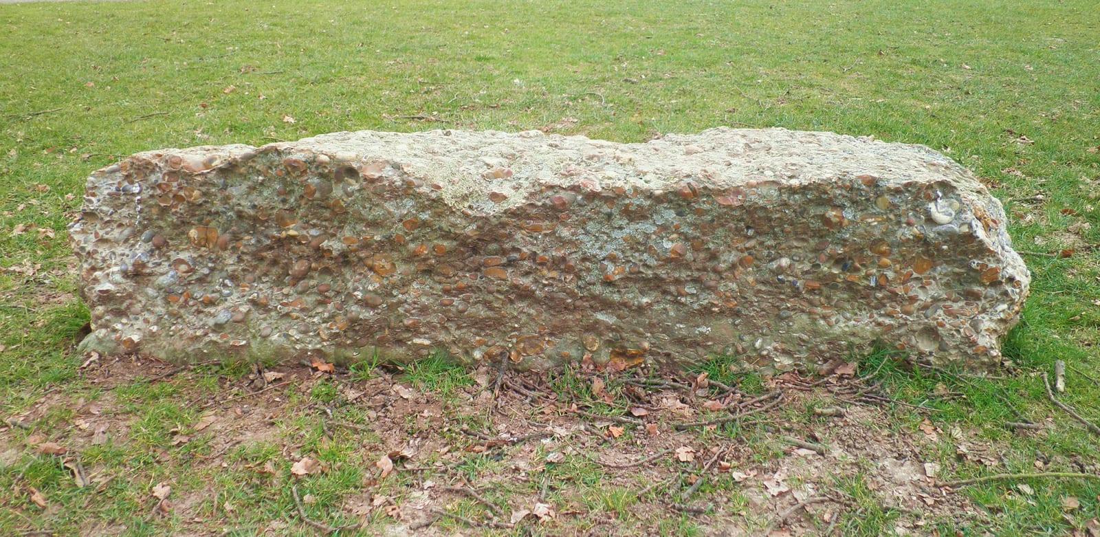
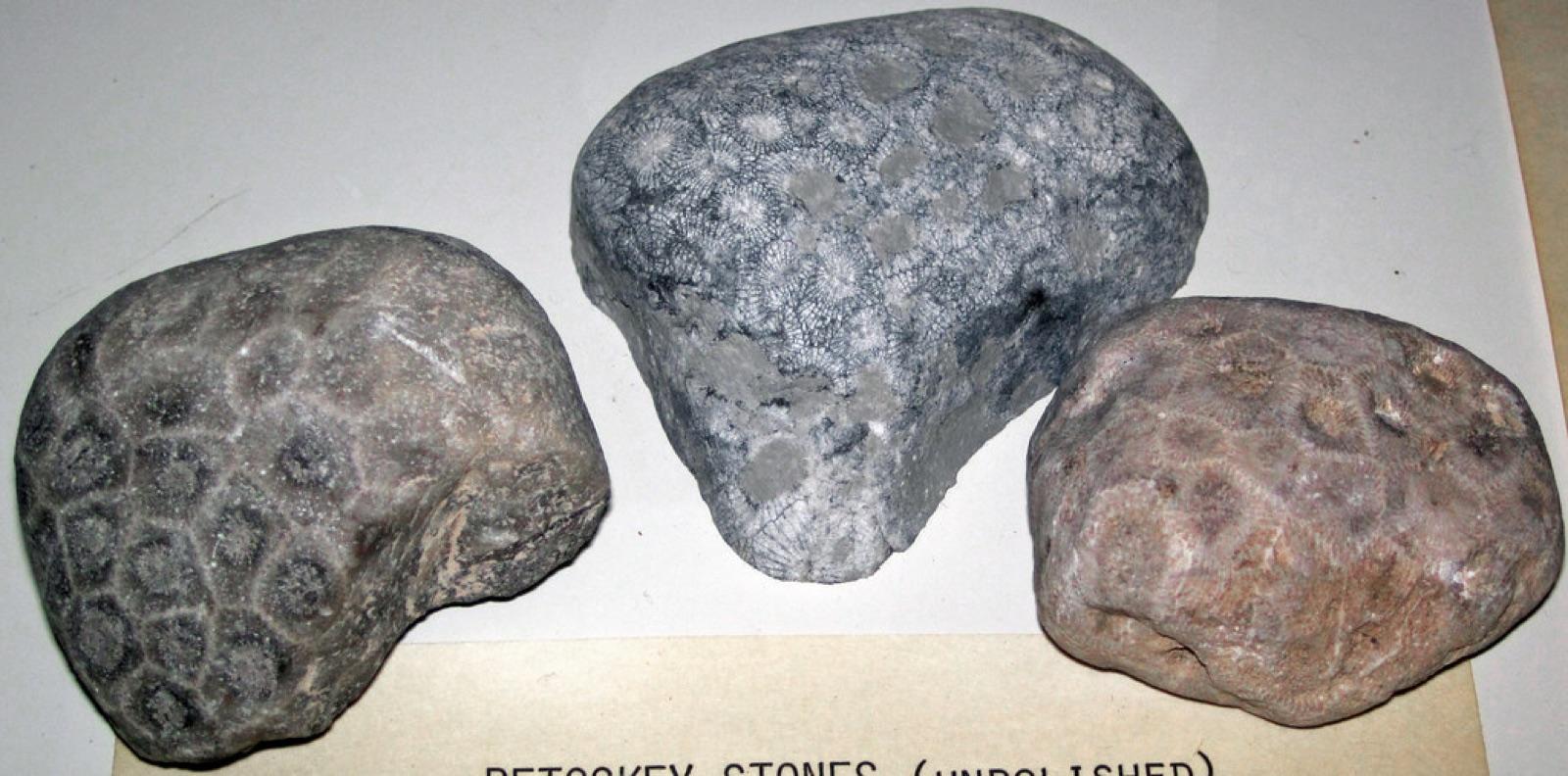
Drummond Island is one of the best places in Michigan to find pudding stone, a striking metaconglomerate of red jasper pebbles set in white quartzite that glaciers carried south from Ontario. The Township Park puts a free public Lake Huron beach and boat launch within five miles of the ferry. The shoreline below the high-water mark is public land open to collectors. Reported finds include pudding stone, jasper conglomerate, petoskey stone. Below: coordinates, access notes, nearby spots, and trip-planning links.
Plan your visit
Generally open to casual rockhounding
- County
- Chippewa County
- State
- Michigan
- Coordinates
- 45.99858, -83.78802
Coordinates are approximate. Confirm the exact ground in the RockHoundR app, where land overlays show which agency manages the area.
Land & collecting status
Generally open to casual rockhounding
Most public-tagged spots sit on BLM, U.S. Forest Service, or other federal land where reasonable hand collecting of common rocks and minerals is allowed. Confirm posted rules and active mining claims before you dig.
Access note: Drummond Island Township Park sits off M-134 about five miles east of the ferry dock, with a free public beach and boat launch. Collect along the public shoreline and the island's extensive state land, stay off private lots, and keep finds under 25 pounds per year.
Public-land rules vary by agency, season, and field office. The RockHoundR app pulls live BLM, USFS, NPS, and tribal overlays so you can see exactly which agency manages the ground at this spot.
Best time to visit Drummond Island (Pudding Stone)
Comfortable months (45 to 90°F highs)
Best months: April to October. Typical highs run 75°F in midsummer and 24°F in midwinter, with winter lows near 9°F.
Climate normals: NOAA 1991-2020 monthlies, DETOUR VILLAGE station (5 mi away).
Today's weather
Is today a good day to go?
The app shows live weather, recent rain, and a daily rockhounding score for Drummond Island (Pudding Stone).
Get the appSources & verification
Spot details combine the public RockHoundR location dataset, normalized mineral labels, agency land-status checks in the app, and community submissions. Coordinates are approximate until verified in the field.
State guidance last verified:
- Michigan DNR, Rockhounding rules
- Michigan Geological Survey
- Isle Royale National Park, Rules
- Community submissions reviewed against published agency rules
Found at Drummond Island (Pudding Stone)
Each name opens all spots that produce that material; the encyclopedia link opens the full ID and field guide.
Nearby rockhounding spots
Other rockhounding spots within driving distance of Drummond Island (Pudding Stone).
- Glen Cove BeachChippewa County, Michigan · 12 mi away
- Hoeft State ParkPresque Isle County, Michigan · 37 mi awayPuddingstone, Granite, Quartz
- Seagull Point ParkPresque Isle County, Michigan · 39 mi away
- Thompson's Harbor State ParkPresque Isle County, Michigan · 45 mi awayGranite, Gneiss, Quartz
- Presque Isle ShorelinePresque Isle County, Michigan · 46 mi awayAgate, Chalcedony Geode, Sandstone With Calcite Vein
- Point Iroquois LighthouseChippewa County, Michigan · 52 mi awayLake Superior Agate, Yooperlite
- Burt Lake BeachCheboygan County, Michigan · 54 mi awayPetoskey Stone, Fossil
- Besser Natural AreaPresque Isle County, Michigan · 55 mi away
Drummond Island (Pudding Stone) FAQ
Where is Drummond Island (Pudding Stone)?+
What rocks and minerals can you find at Drummond Island (Pudding Stone)?+
Is collecting allowed at Drummond Island (Pudding Stone)?+
What tools should I bring to Drummond Island (Pudding Stone)?+
When is the best time to visit Drummond Island (Pudding Stone)?+
How do I get to Drummond Island (Pudding Stone)?+
More rockhounding in Michigan
See all 119 Michigan spots →
Open Drummond Island (Pudding Stone) on the map
Use the RockHoundR app for live land overlays, weather, geology, directions, and saved finds.